Owner: Logan Bertolette
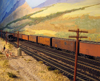
South Line layout portrays the remoteness of the SP over the former El Paso and Southwestern and includes the coaling tower at Mescal and the smelter at Douglas which occupies over 13 actual feet of wall including the slag pile.
The South Line was part of the Rio Grande Division, until that division was incorporated into the Tucson Division.
Hear the Logan's too humble description:
"Having neither the time, talent or finances to exactly replicate the SP in Southern Arizona, my goal was to capture the flavor of the ex-EP&SW’s South Line on SP’s Rio Grande Division.
As a teen growing up in the Southeastern portion of Arizona, I was fascinated by the remnants of the EP&SW and the mining and smelting operations so prevalent in the area.
The layout is housed in a 14’x22’ building which happens to be just a few feet from the former SP’s Coastline.
There is still much to do on the layout. The smelter at Calumet is not prototypical, but sufficiently hideous to serve. The Bisbee/Douglas peninsula, including the pit mine at Bisbee and the yard at Douglas, remains largely unfinished"
Taste here some pictures:
skip to main |
skip to sidebar
List of RR models layouts themed and representing portions of Southern Pacific lines.
Visitor Locations
The Friendly Southern Pacific is alive in our hearts
This list contain single owner's personal Layout reference.
No Clubs or Museums display.... simply too much!
I hope this list can push some undecided modelers to start the "dream" in a real world and to select one of the astounding panoramas along the tracks of the Southern Pacific "Golden Empire" .
How to use this site:
- Use the "Division" list above to display your wishes.
- Use the Buttons on each Layout description to link to Web site or Picture Album.
List by Division / Layout theme
- §- State Belt RR - San Francisco (3)
- §-Northwestern Pacific (2)
- §-South Pacific Coast R.R. (1)
- §-SSW (The Cotton Belt) (2)
- §-WP and Subsidiary (2)
- ° Proto-Freelance and "what if" (22)
- °- Narrow Gauge (3)
- COAST Division (20)
- El Paso (TX) (1)
- LOS ANGELES Division (6)
- PORTLAND Division (12)
- Rio Grande Division (1)
- SACRAMENTO Division (6)
- SALT LAKE DIVISION (1)
- SAN ANTONIO Division (4)
- SAN JOAQUIN Division (4)
- SHASTA Division (7)
- STOCKTON Division (1)
- WESTERN Division (2)
If you want to change a description or add your layout to the list, please write down :
- Layout name (if any)
- Your Name-Surname
- Scale and era modeled
- Town and State
- A short description of locale modeled, layout dimensions, rolling stocks or any additional info you feel important.
- if you have a Web site or a Picture album, don't forget to add the links
Send a mail here :
- Layout name (if any)
- Your Name-Surname
- Scale and era modeled
- Town and State
- A short description of locale modeled, layout dimensions, rolling stocks or any additional info you feel important.
- if you have a Web site or a Picture album, don't forget to add the links
Send a mail here :

Credits
As this place is mainly the result of my Internet browsing, mostly of the layout descriptions you find here are simply obtained using the “cut©” tool on several source : layout owner web pages, picture albums , NMRA Division web sites and Layout tour list and spare forums and Yahoo group that I’m member..... Why reinvent the wheel?
This place can’t be there without so many information spread around the Net.
I want say a big “Thanks” to so many involuntary contributors ( I can’t list all here as was basically a backup of this site!) .
A special credit to Bob Chaparro for his devoted big effort for the Hobby, the organization of many Layout tour and the creation of the Yahoo group “Model Railroads Of Southern California”
http://groups.yahoo.com/group/Model_Railroads_Of_Southern_California/
I’ve used “as is” lot of his layout descriptions in the group layout tour annunciations.
My last suggestion:
-> subscribe this site as "Followers" ... we all like to know you!
Followers
Pages flipped 'till your visit:


1 comment:
Lovely blog you havve here
Post a Comment